Iceland Day 12 (Aug. 18, 2025): Hellnar Coastal Walk, Snaefellsnes Peninsula, Kirkjufell, and northern lights!!

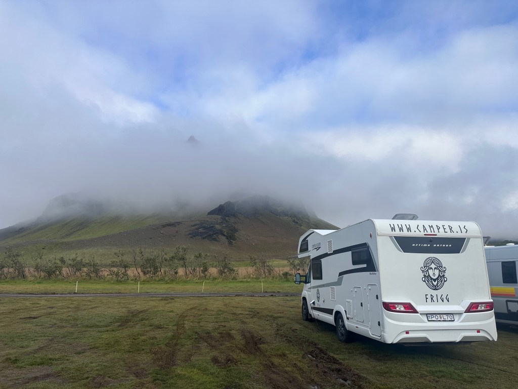
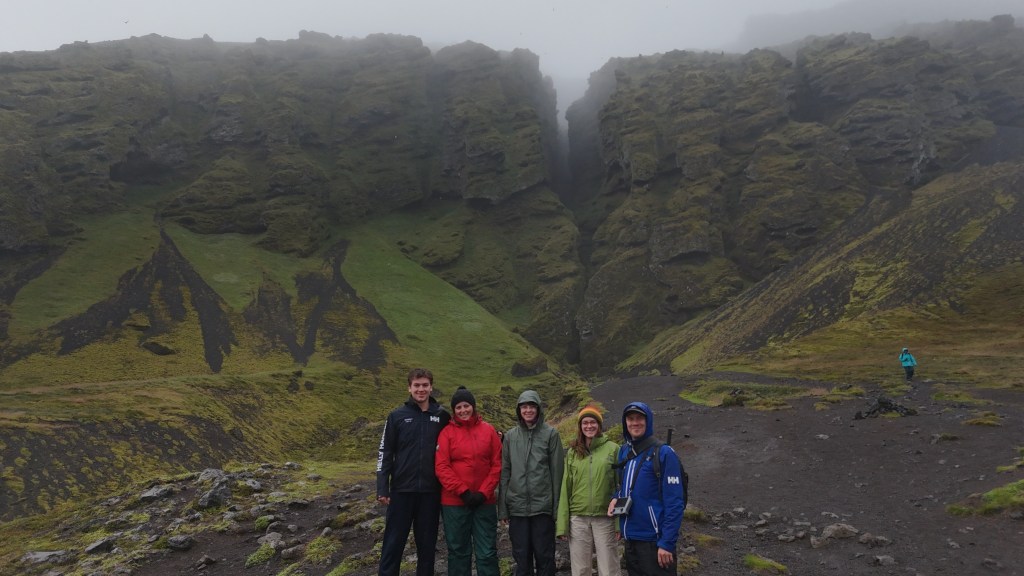
(Jo) Today a long but rather incredible day — perhaps a favorite for Lin and some of the kids. We woke up to some low clouds but more clearing and hints of sunshine that gave us hope. Our campsite was still pretty muddy so we had a little excitement trying to get out of our spot this morning with some spinning tires. Most campgrounds here are just big fields, and some have vaguely marked individual sites. Fortunately, Lin figured out the camper handled the mud better in reverse and so we could just back across the field to the road that looped around it. 

We drove a few minutes to the Hellnar Coastal Walk, which was about 2.5 kilometers along a very diverse coastal landscape of cliffs and lava formations. Eden decided to run it, so we met her as she came back. The sun was coming out, and it felt very warm – most of us were wearing no jackets at all. The trail led to a lovely cafe where we had some waffles with rhubarb jam and cream and Skyr cake before retracing our steps back to the camper. There were lots of overlooks along the way, amazing rock formations and arches, and large colonies of seagulls. And there were crow berries galore. Eden picked a whole ziplock bag full! And Kieran was a good global citizen and picked up a significant amount of trash along the route. 

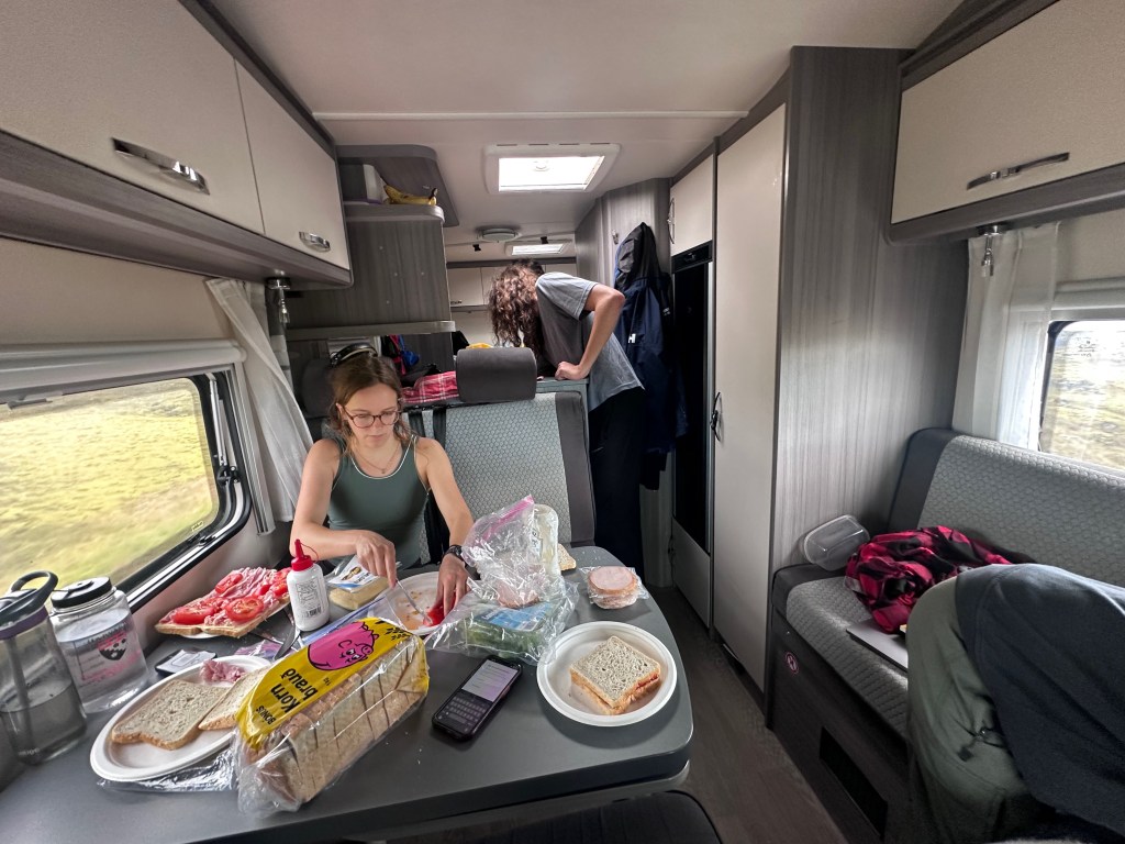
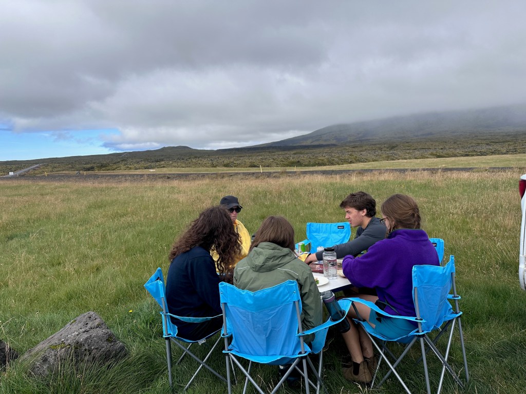
We then headed into Snæfellsjökull National Park, one of three national parks in the country (and we hit them all on this trip!). We wanted to picnic so we drove to another overlook by the sea and ate our picnic lunch by the camper before hiking the short distance to take in the views of the coasts and several rock formations in the distance. 

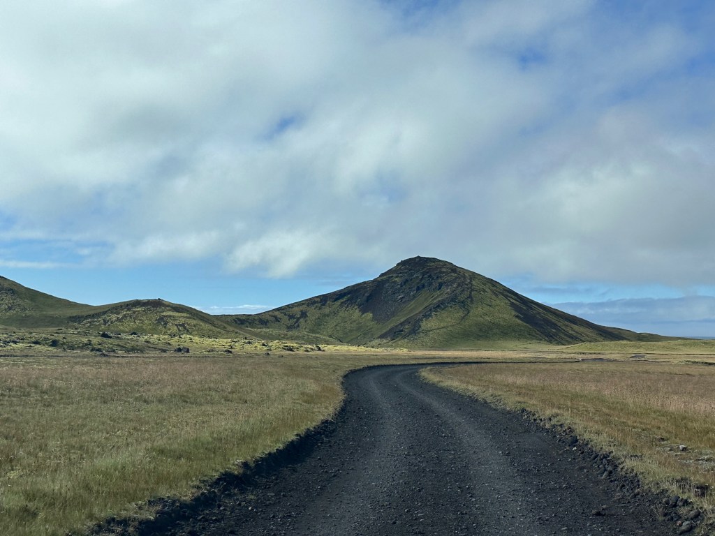
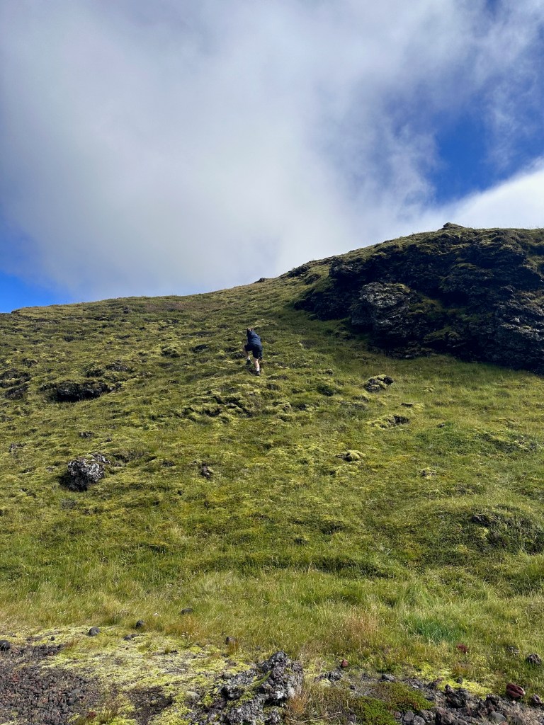
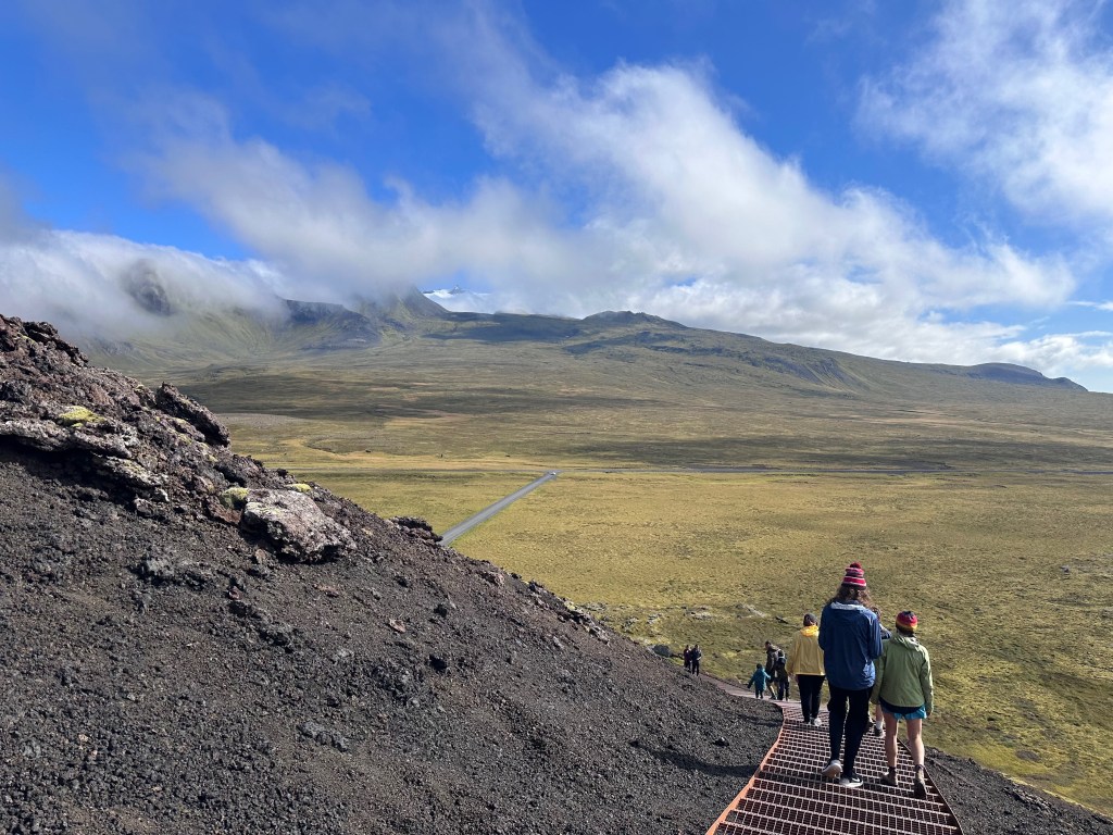
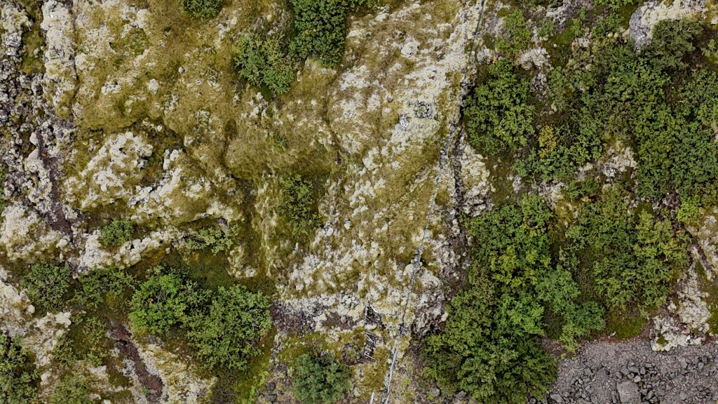
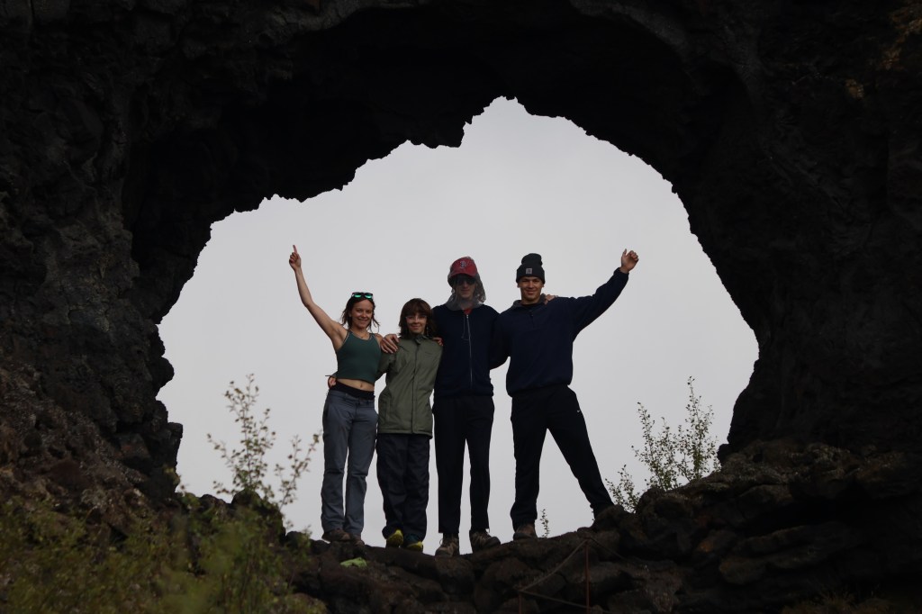
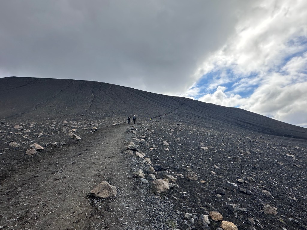
Then we headed off the main road to a small volcano, Hólahólar, that we could drive right into. We were the only people there and it was a lovely green setting. We all ran up the slope and then made our ways back down, some attempting to roll part of the way—not recommended! It was very steep! Lin flew the drone since there was no one around and no wildlife to disturb.

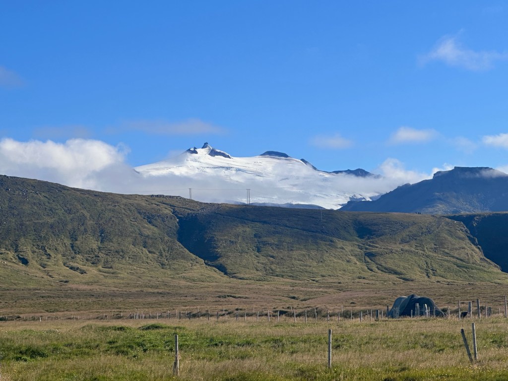
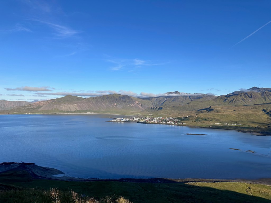
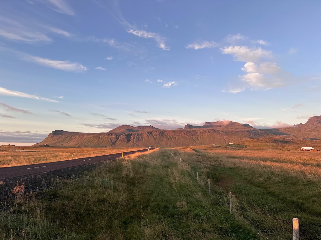
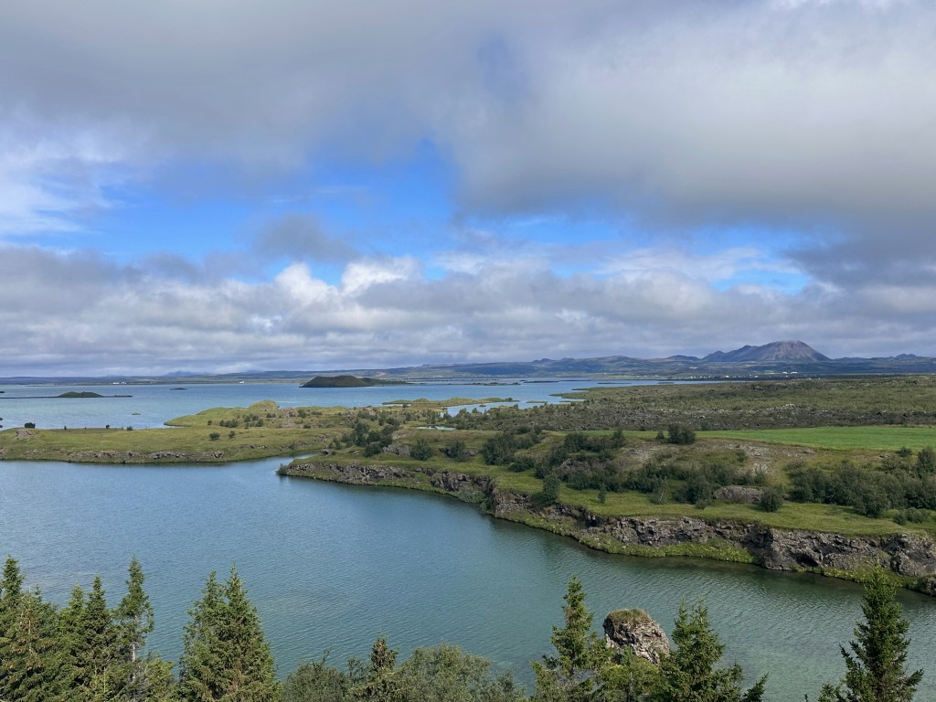
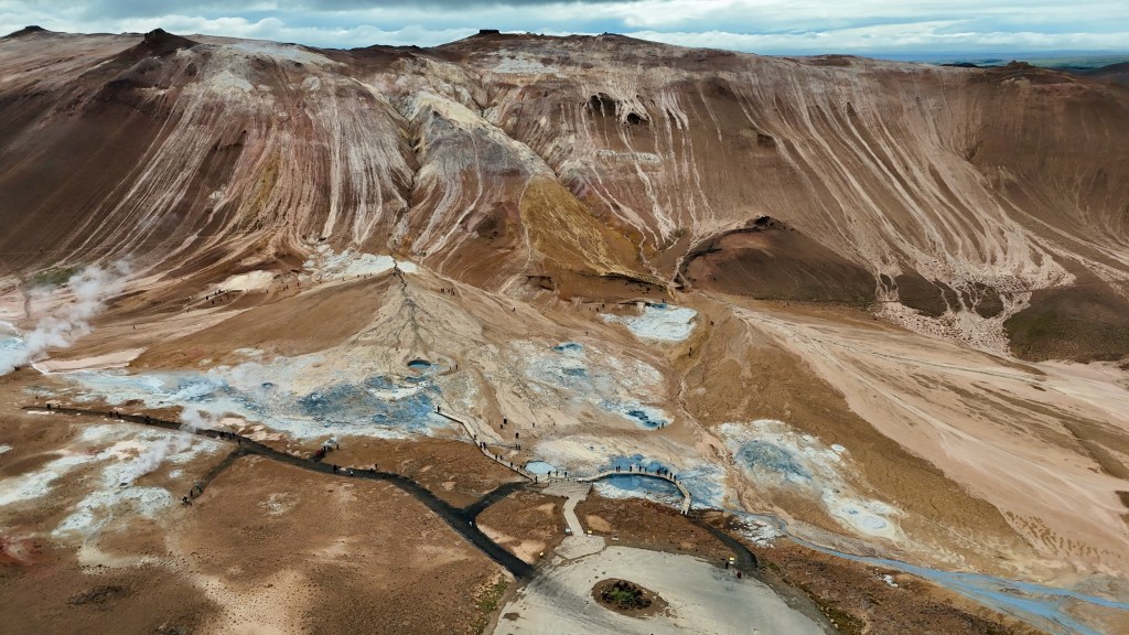
Snæfellsjökull National Park is perched on the west end of Snaefellsnes Peninsula, and there is one main paved road that does a semicircle through the park, roughly paralleling the coastline, and going around the central mountain feature and glacier. As the day progressed, we were able to see more and more of the mountain and glacier at the top.

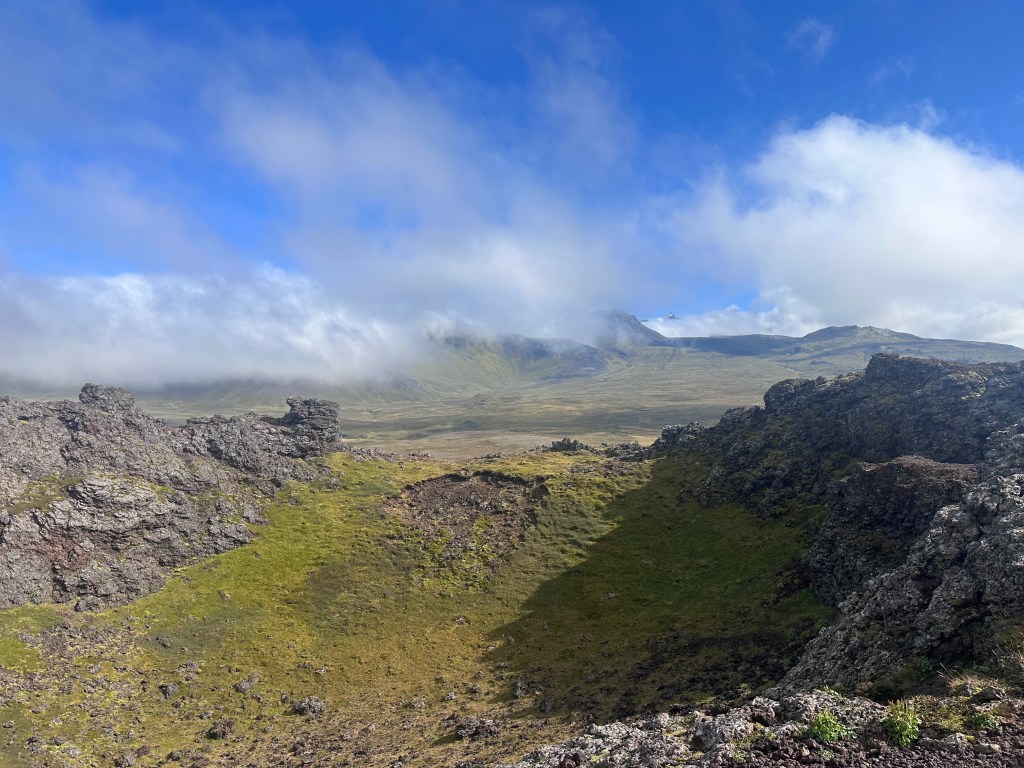
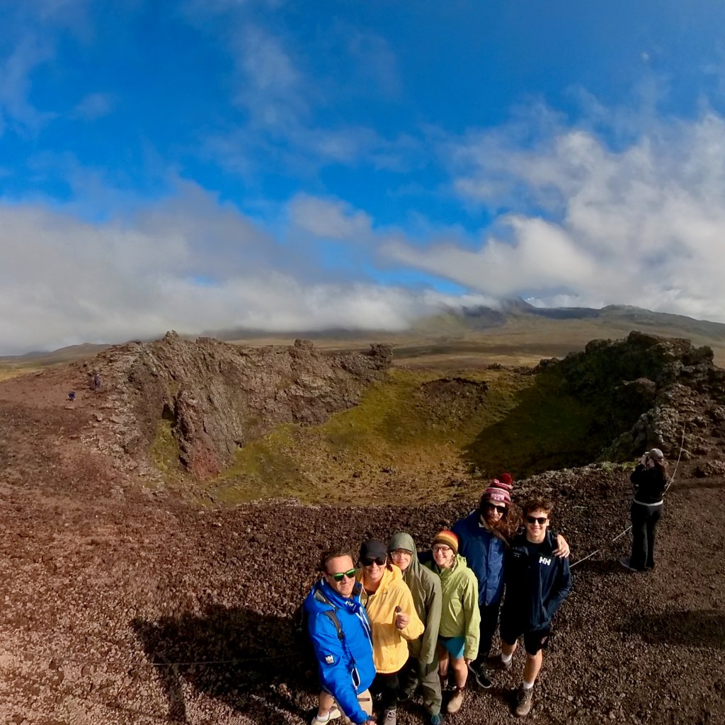
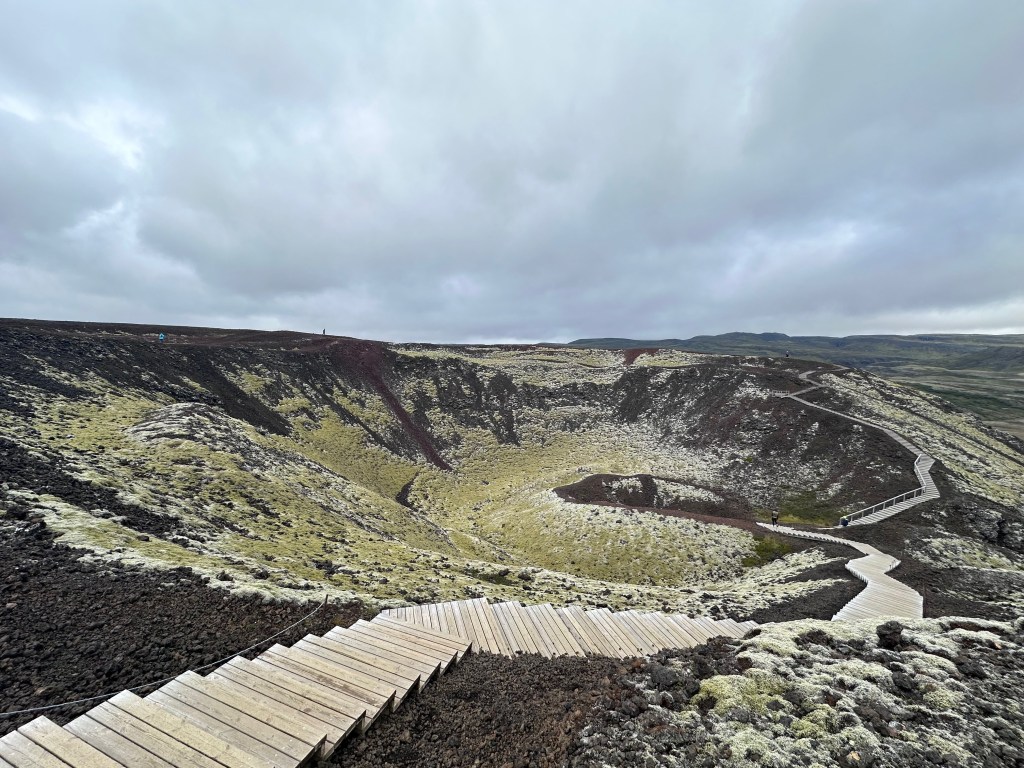
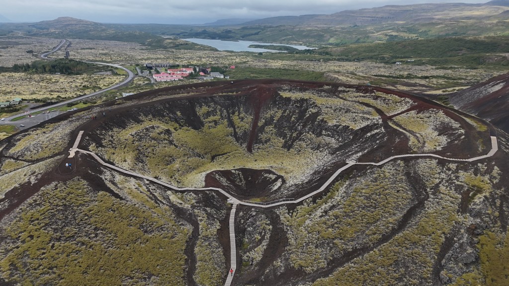
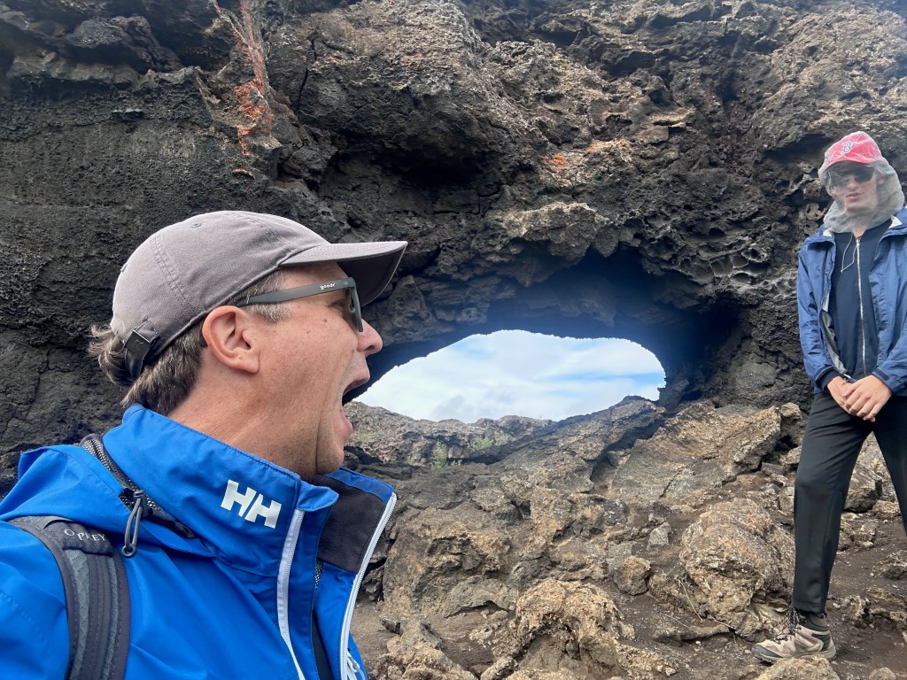
Our next stop was the Saxholl Crater, which was easy to drive to. There were also metal stairs that led to the top, with some walking paths at the top, too. The kids were in peak silly mode for some reason.

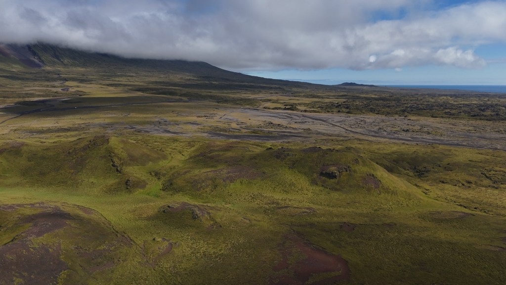
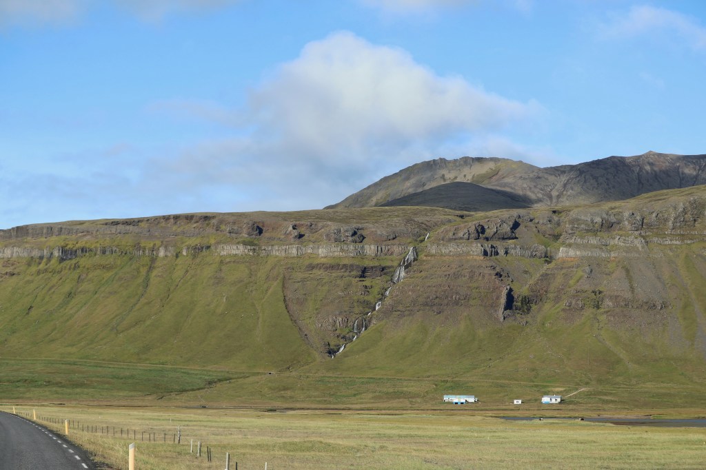
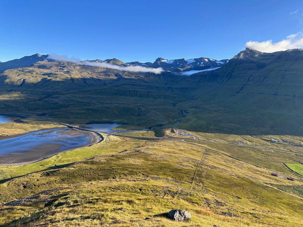
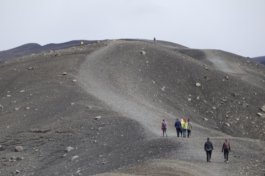
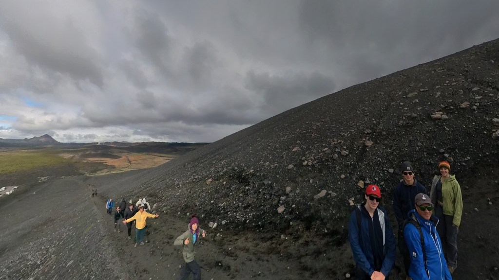
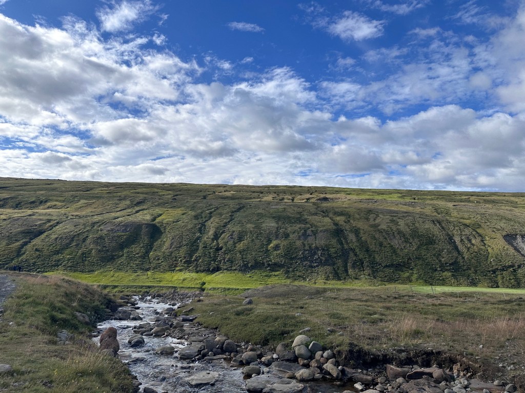
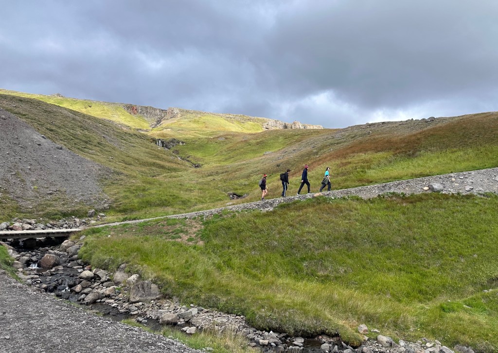
We decided to head away from the coast a bit and try an inland hike, the Raudholl trail. Lin and Eden both have the AllTrails app, which allows them to look for nearby hikes. Lin thinks there should be one for fosses (waterfalls) in Iceland, too. To get to Raudholl, we needed drive back an F road which we decided to attempt even though F roads are supposed to be regulated for 4-wheel drive vehicles only. Lin had read it wasn’t too bad so we went for it and lived to tell about it. The road was pretty rough and rocky but really not impassable for the camper. Raudholl was yet another volcano / crater hike — under 2 miles total but so scenic and only a couple of other people visible from a distance. We hiked up and around the crater, but with huge mountains looming over us, which was cool. Oodles of crowberries and blueberries once again! They serve as a pretty consistent ground cover all over but are only a couple of inches high—definitely not the blueberry bushes we are used to seeing at home! 

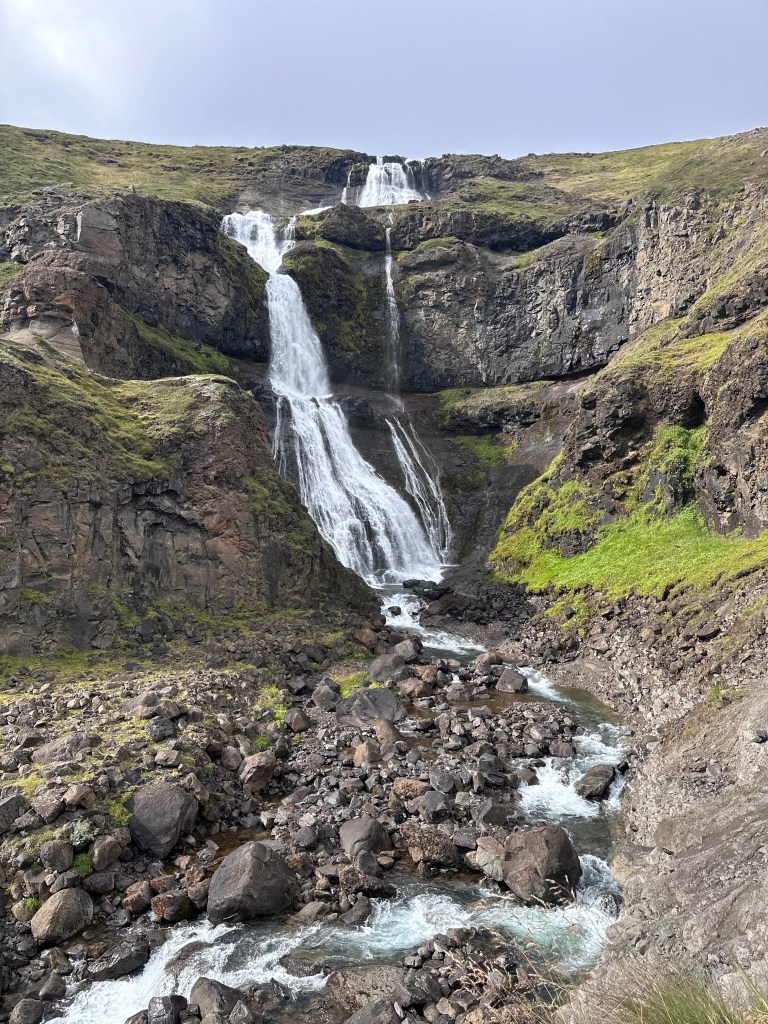
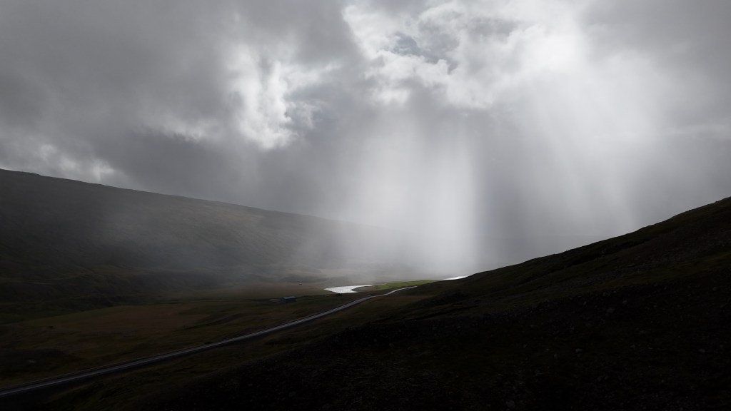
From there, we drove out of the national park to a short hike to another pretty waterfall—Svudafoss. The hike was delayed by a pole near the parking lot where most of the family tested their strength as they attempted to human flag (hold your body out horizontally using only your hands/arms—it is harder than you think!). Most were successful for at least a split second! The hike to the falls had a nice raised metal grate pathway through the fields. The only thing disturbing the peace was a trio of local teen boys on their dirt bikes who ripped past us, hung out by the falls for a bit, and took off again, leaving exhaust in their wake. Lin tried to capture the beauty of the falls with the glacier in the background with his drone. We were able to hike up pretty close to the base of the falls.

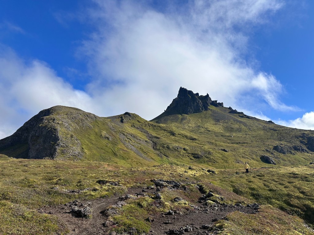
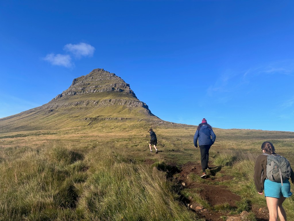
After the falls, we pivoted our plans since it was such a gorgeous day and headed to Kirkjufell, one of the most famous spots on Snaefellsnes peninsula and it is also featured (briefly) in Game of Thrones. Lin really wanted to hike it while it was sunny and clear and the forecast for the next day was not promising that.

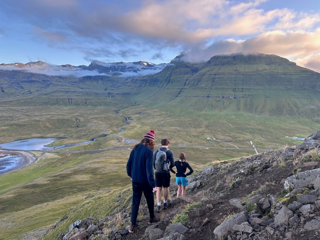
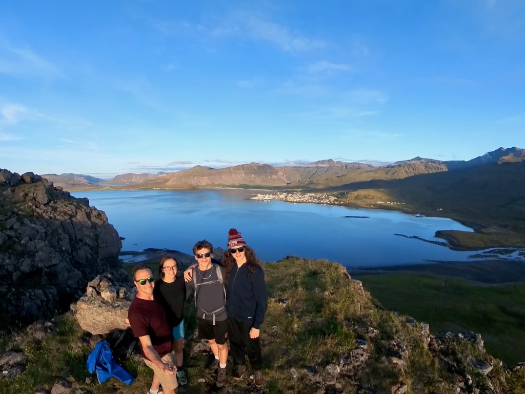
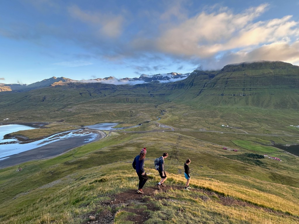
(Lin for a moment) The drive there was epic – with the setting sun at our back and illuminating the full cliffs and mountains all the way there. At one point the road climbed way up a mountain along the coast with a huge drop straight down (and guardrails, thankfully). We rounded the corner on the way down and, suddenly, there was Kirkjufell, looming in the distance, and it was HUGE. OMG. Like scary huge. Way larger in real life than in pictures. I had been looking forward to this hike for months, but suddenly felt unsure I could do it!! But we had to at least try. Since we had already put on more than 20,000 steps for the day, Kieran decided to opt out. Jo took the slow pace with the goal of making it up a couple of levels, and the rest galloped off to attempt to conquer the mountain. 

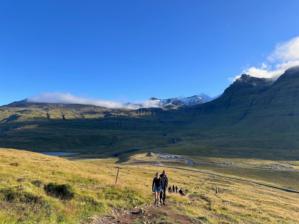
(Jo again) Jo stopped after the first super steep section, but even from there, the views were pretty incredible—up into the mountains and glacier and out to sea. Just as she was starting back down, a couple of pretty big rocks tumbled down the next level up, which was pretty freaky. Eden, Elliot, Harrison, and Lin soon reappeared just above where the rocks had fallen so Jo shouted up a warning. Elliot went another couple of levels beyond Jo before he called it quits and waited for the others to return. Lin, Eden, and Harrison went up another level but the rockfall, steep heights, and precarious scrambling on pretty tired legs played into their decision to not attempt making it to the top this time. 

(Lin: in truth, Harrison and Eden would have continued on, but I was depressed to see that, after quite a lot of serious technical scrambling and hiking, we were only like three-fifths of the way up, with much more difficult sections to go (according to AllTrails). With the sun setting, I pulled the plug, and Eden and Elliot were gracious about it. It was much more precarious and dangerous than I anticipated, and to me not worth the risk given our tired legs and the sunset. BUT the view up there was indescribable – so high up, and so immediately in front of us – the huge mountains straight ahead, ocean to the right, and large lake and town to the right. We sat there for a bit, taking it all in.)

Jo chatted with another hiker briefly—a business and finance student from Prague who is working at a hotel in Iceland for a second summer. He said the opportunities to do these kinds of hikes are “good for the spirit but bad for the knees.” 🤣

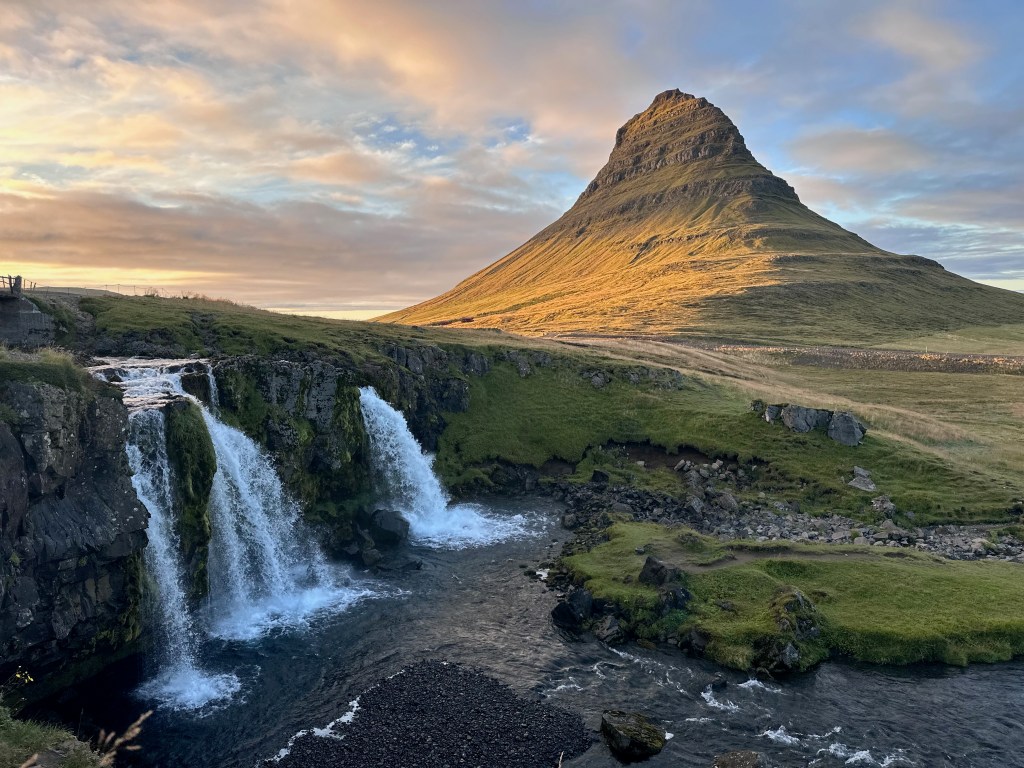
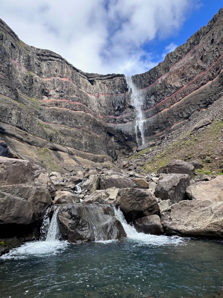
Jo returned to the camper and walked with Kieran to the Kirkjufellfoss waterfall for some photos before the others returned and Lin took some more waterfall pics. It is a super picturesque spot , and at sunset the sun illuminates the mountain with the waterfall in the foreground.

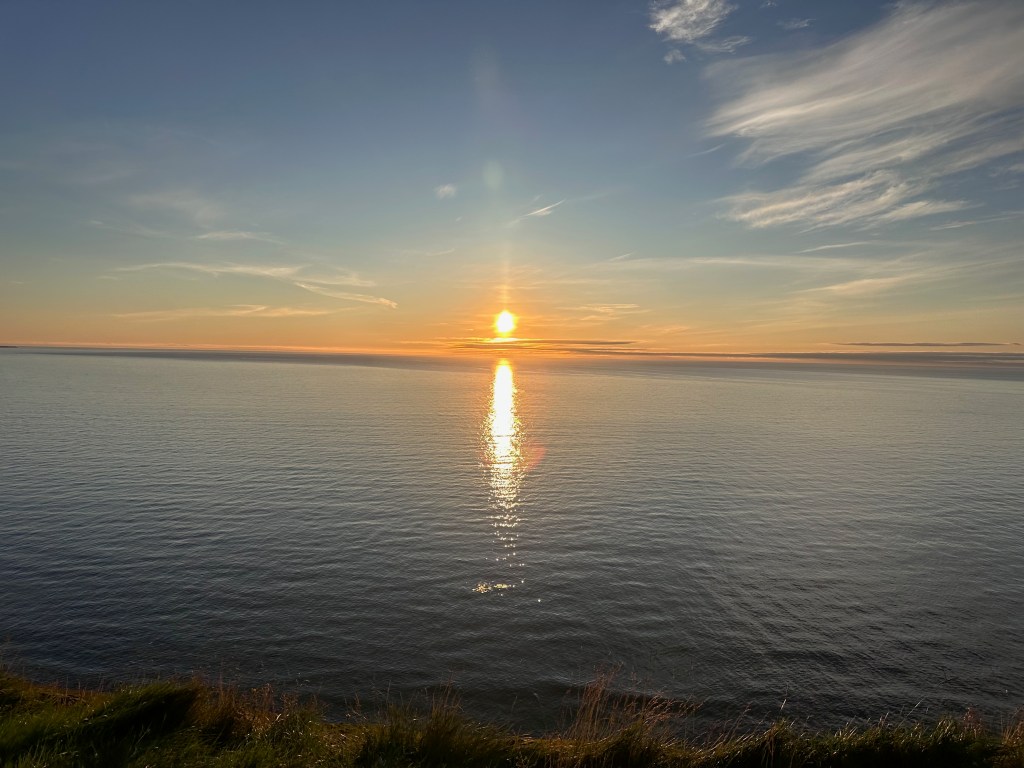
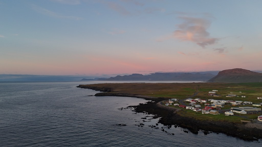
It was about a twenty minute drive back to the campground, and we were sort of racing the sunset since we wanted to view it on the water. We wanted to stop at a gorgeous beach we had seen along the way but there wasn’t parking so we drove to Hellisandur and found a place to park by the water and watch the sunset over the ocean. Sunsets do last kind of forever here so we headed to the campground after the sun disappeared and Lin had flown his drone a bit. The soft sunlight still bathed the Snæfellsjökull glacier, which was now visible, for an additional half hour. So lovely.  

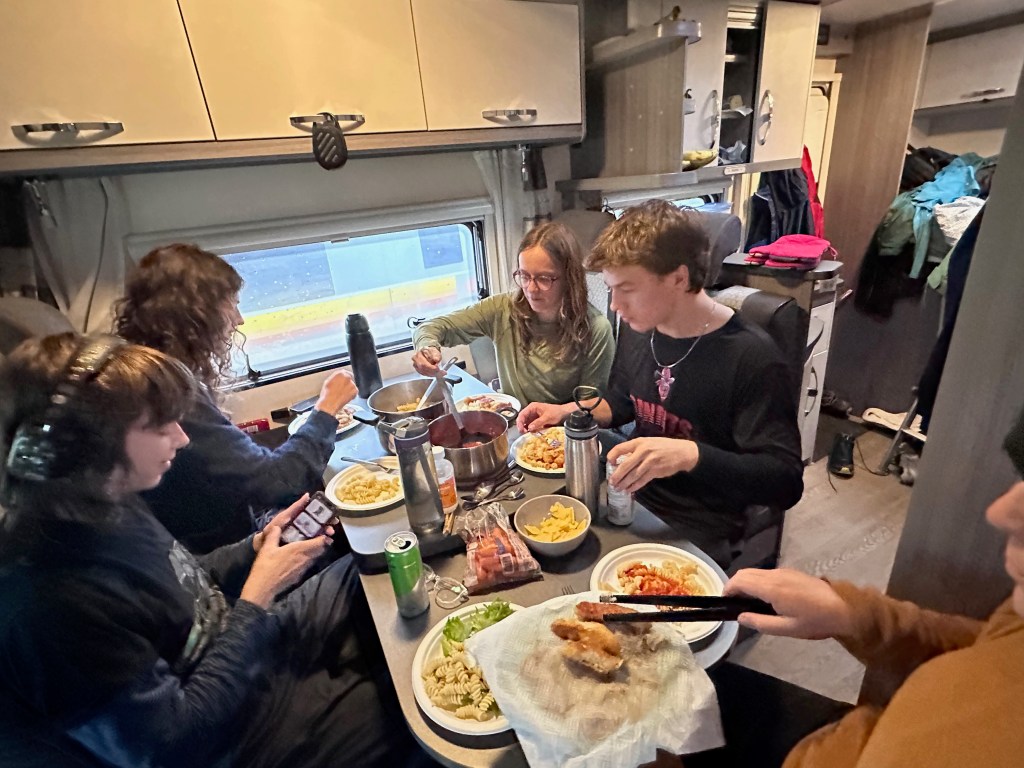
Once again we rolled into our site at Hellissandur Camping on the late side—around 8 or 9 has not been uncommon. We then sat around the dinner table talking for quite a while chatting. Eventually Lin headed out to the campground restroom around 11:30 pm and happened to look up and notice some northern lights on his return. We all stumbled out to enjoy a beautiful, constantly changing show of greens and purples with the orange glow of the sunset still on the horizon and the Big Dipper also easily visible, along with a crescent moon. It was on the chilly side but some of us stayed out for a good half hour enjoying the show. The season for northern lights officially started last week, but we weren’t even looking for them and just got really lucky with a beautifully clear sky. It was pretty incredible! 

It’s hard to believe that after tonight, we will just have one more sleep in our trusty Frigg (camper).

Iceland Day 11 (Aug. 17, 2025): Silver Circle and Snaefellsnes Peninsula – craters, hot springs, seals, and incredible mossy slot canyons

(Jo) 

Overnight we had a ferocious windstorm – so strong that we all woke up to a rocking van. We had parked the van pointed into the wind when we arrived, but the wind directed shifted overnight, so we felt it a lot. Eden was sleeping outside in her tent but decided to pack up in the wind and come inside rather than risk having something get damaged. 

Our plan was to drive slightly east to Snafellsnes Peninsula and spend two days there, but since a huge rain system is sitting on the peninsula today, we instead opted to drive southeast to the Silver Circle, a series of attractions and sites in West Iceland. We lazed a bit, had breakfast, and then did the usual campervan flush out and fill up before hitting the road. Our drive took us past the creamery and into the gorgeous lush Scottish Highlands like valley we saw yesterday. The landscape continues to amaze us all – every corner presents another topographical feast for the eyes.

We first headed to Grabrokargigum, a series of three volcano craters. We hiked to the top of one (way too many stairs to count) and circled the top, being careful to not get blown over the edge by the strong winds. Some of us stopped by the lava-walled sheep pens on the way back down—Old Brekka Corral. Lin flew his drone for a bit.

A short drive took us to Glannifoss. The trail was lined with greenery including oodles of blueberries that distracted Eden and me. Yum! Glannifoss was on the smaller side but we all agreed it was lovely and we’d all enjoy playing in the little pools at the bottom of the various levels of the falls on a hot day! 

Then it was on to Staldrid where there are crazy hot springs (Deildartunguhver), which bubble and spray but are too hot to even touch. We picked up some lunch at the food truck—the infamous Icelandic hotdogs (loaded with raw and fried onions, and various sauces), tomato soup, and a couple of overpriced panini sandwiches, which we ate in the tomato greenhouses that also had impressive lemon cucumber vines. 

We stopped by a nearby horse farm (Sturlureykir) that gives tours of their stables and bakes bread with the geothermal heat. We debated but opted out of the tour after a busload of people showed up. The horses were lovely, though.

After Lin realized that the rest of the Silver Circle was on gravel roads, we opted to cut that tour short. We drove south and through Borganes (where Eden and I had been in 2024) and headed for the Snaefellsnes Peninsula. The weather turned sour as we entered the rain system – very low cloud cover and foggy. We knew there were sights to see, but we couldn’t see them! We stopped by the ocean at Ytri Tunga to check out about a dozen seals lounging on the rocks and seaweed. Then it was yet another waterfall hike–Bjarnafoss. It was misty and pretty foggy so we couldn’t see the top of the waterfall as we climbed. It got pretty precarious with the mud and rocks so only Lin, Eden, and Harrison ventured near the top. They basically had the place to themselves, and enjoyed the challenge of the steep rocky and muddy scramble. 

We then drove to Búðakirkja, the black church—extra atmospheric in the mist and then made a last-minute decision to stop at Raudfeldar Canyon. How could we resist the incredible mossy green cliff face and small gorge opening that was visible from the road through the mist? It was a fairly short walk up to the opening of the slot canyon, which was in moss-covered cliffs that are reminiscent of Easter Island statues. We had to rock jump to get into the canyon via the small stream. It opened up a bit inside and then narrowed again. Eden, Harrison, and Jo continued back the extremely narrow canyon with the kids making it pretty far, even with Harrison wearing his sandals since his hiking boots had gotten damp inside! All in all a very cool stop just minutes from our campground at Arnarstapi.

The Arnastapi campsite was super muddy but mostly empty, so we found a spot with electricity and settled in for dinner, showers, etc. Once again, it felt like a super diverse, fun, and full day, with very different weather systems and activities.

Iceland Day 7 (Aug. 13, 2025): Lake Myvtan region, Dettifoss, and Selfoss

(Eden and Lin) 

Note: Pictures at the bottom

Had an excellent night in Campground Fjalladyrd/Mödrudalur. We were up on the earlier side, including Eden, while Lin had the coldest shower of his entire life since the water heater was not working in the bath house. Rather unusually, they charged for showers at this campground, but since the hot water was broken, it was free. 😉 We do have a heated shower in the camper van, but we have used it sparingly. Actually, the van is pretty cool – has huge propane tanks that power the fridge, the hot water, the camper heater (forced air with ports all over the living areas), and the stove. When we plug it in at a campsite, the fridge switches to electric. So you can have hot water, the stove, and fridge even if not plugged in. It also has a “house” battery for lights, etc. There have only been a few nights where we could not access a plug (this was one of them), and the only downside is that I have to rely on an array of battery bricks we brought to charge the phones and my laptop. Otherwise, we wouldn’t really need electricity.

(Eden and Lin) 

Note: Pictures at the bottom

Had an excellent night in Campground Fjalladyrd/Mödrudalur. We were up on the earlier side, including Eden, while Lin had the coldest shower of his entire life since the water heater was not working in the bath house. Rather unusually, they charged for showers at this campground, but since the hot water was broken, it was free. 😉 We do have a heated shower in the camper van, but we have used it sparingly. Actually, the van is pretty cool – has huge propane tanks that power the fridge, the hot water, the camper heater (forced air with ports all over the living areas), and the stove. When we plug it in at a campsite, the fridge switches to electric. So you can have hot water, the stove, and fridge even if not plugged in. It also has a “house” battery for lights, etc. There have only been a few nights where we could not access a plug (this was one of them), and the only downside is that I have to rely on an array of battery bricks we brought to charge the phones and my laptop. Otherwise, we wouldn’t really need electricity. 

We finally wrapped up and said goodbye to our favorite campground so far and drove back out the gravel road to route 1 before driving up out of the immense flat highlands (rimmed with mountains) and down into the Lake Myvtan region. Our first stop was at Höfði, a peaceful little wooded peninsula jutting out into Lake Myvtan that has lava pillars in the water. We had read online that Lake Myvtan is known for small annoying gnats called midges, so we dutifully pulled out our headnets that we had packed before stepping out of the camper. Immediately, we understood why! Dozens of midges swarmed around our heads, although once we were on the trail, they were generally less present. They don’t bite at all, but it is unpleasant without a net to say the least. Eden was the most experienced net-wearer of all of us, having to sport one almost all the time she was outdoors in Alaska for the past two summers conducting research for her senior thesis. The hike was peaceful, with the best view of the lake at the end. 

From there we drove a few minutes down the road to Dimmuborgir, which is a large lava field with unique lava formations. We did a mid-length trail of two miles or so, which took us through the center core of the field. Eden immediately spotted wild blueberries, so we all spent more time than the walk required, picking blueberries along the way – some for immediate consumption, and others to keep for tomorrow’s breakfast (kept safe in a ziploc). Before leaving, some of us paid for the restroom – the first time for us, since most of them have been free (and we have one in the camper van, too). 

Next was Hverfjall crater, a massive volcano with a 2.1 mi loop around the perimeter of the crater up top. It required a steep climb but once up we were rewarded with views of the massive crater to one side and views of Lake Myvatn/geothermal area/mountains to the other. We immediately began an intense familial debate about which direction to traverse the rim: clockwise, which consisted of a series of slight uphills and slighter downhills until the peak, after which was a sharp downhill, or counterclockwise, which was the opposite. We decided on the latter. I think this is about as close to “fighting” as we get as a family – more of a low-stakes debate (although of course we have minor annoyances with each other in such a tight space over two weeks). The views were stunning and the trail conversation was silly and we were all in good spirits, especially so because we could see rain in the valley below but it never reached us. On the frolic down, inspired by Harrison’s baseball practice (throwing baseball sized rocks into the crater – which was devoid of people), Dad challenged Kieran and Eden to estimate how long it would take to fill the crater if every visitor threw one rock into the middle, with the assumption that the crater sides would not shrink in size with every rock removed. We approximated 36k years. In case that was a question in anyone else’s mind.

After that was the Hverir geothermal area, which somehow smelled worse than the campervan. We didn’t stay long but the sulfur smoke and resulting colors of rocks were cool! Like Yellowstone but not. Lin flew the drone from a distance, being sure not to fly over people. 

Then was a half hour drive north, again leaving the Ring Road, to Dettifoss, (disputedly) the most powerful waterfall in Europe. The falls themselves were a little underwhelming because the mist and direction of the wind blocked much of the water itself, but it was neat to see. And the landscape was crazy! Not much vegetation — looked like Mars.

After viewing Detifoss, Eden set out north on a long trail run of 20 miles to our campsite. She and Lin are both training for the Canyon de Chelly ultramarathon in Arizona in early October, but Lin has paused his training due to knee issues, so he couldn’t join her, sadly. The rest of us walked a bit to see a Selfoss, a second and much wider waterfall upstream. 

We loaded back in the van and drove the 20 miles to Asbyrgi campground, situated within a large horseshoe-shaped canyon with walls that are between 50 and 200 feet tall (with the tallest being at the center of the “U”). The campground was large and shockingly nearly empty, so we had our pick of spots near the canyon wall, and with electricity. Lin started on dinner and eventually Eden arrived, having hit 20 miles! Her run was mostly downhill, but through an insane diversity of landscapes, from the moon-like landscape, next to rivers and canyons, including a significant small river crossing, through low vegetation / forest, and then down the canyon face (mostly using a rope). She did not see a single person the whole time. Sort of freaky. 

Harrison and Lin threw a football outside around 10 pm – trying to keep Harrison’s pitching arm in shape! 

We are averaging approximately 20,000 steps per day, which is excellent. Some days I am closer to 30,000 – and sometimes those include arduous hikes. It feels good to drop into bed feeling like you’ve done something. Each day we drop things from our itinerary, though! Lin had done a ton of preparatory research, and then Eden put together a preliminary itinerary for most days that Lin and Eden both filled in. It’s worked out pretty well so far, but requires both of us to scramble the night before and sometimes on the road, finishing the details and finalizing things that we want to do. 

(Note: you can click the images to see larger versions.)

Iceland Day 6 (Aug. 12, 2025): Hengifoss, Stuðlagil Canyon, Rjúkandi, and the wide open northern region.

(Lin)

[Note: pictures at the bottom]

Camper-van-ing with teens and college-aged kids is interesting, since we all have different bedtimes and sleep needs. Some of the kids and I stay up late, but then we want to be up and on the road much earlier than they do. It’s been working, though. Today we woke up, made breakfast, some of us showered, and then I (Lin) did the usual emptying of the black water container “cassette,” draining the grey water in the designated place, and filling up the drinking water in the camper van. I also filled up with diesel before joining the others at a fun discount grocery store, where we refilled on some snacks, bread, milk, chicken, and other goodies. 

We hit the road and headed south, driving along Lagarfljót, a lake supposedly with a lochness-type monster in it. On the east side we drove through part of Hallormsstadhaskogur, supposedly the largest forest in Iceland (of which there are not many!). Around the southernmost tip was a beautiful waterfall named Hengifoss, famous for its red rock horizontal stripes. As we approached, it was quite visible from the road a ways back. We pulled into the parking lot and began the usual way-too-long process of getting shoes, jackets, water bottles, snacks, backpacks, cameras, etc. etc. The trail up was steep but well maintained – a lot of the larger, popular stops have sort of a plastic grating down to help with mud control as well as ice and snow (in the winter). On the way we passed a smaller waterfall, Litlanesfoss. We went up to the viewpoint to see Hengifoss, and quickly realized that people were hiking the quarter or mile up to the falls itself, so we did, too. It was actually really fun – a lot of rock hopping and navigating steep banks, etc. At the top you go right up to the beautiful blue pool that was completely obscured from down below. We spent some time taking pictures and wondering at the power of the falls. 

On the road again, our next planned stop was Stuðlagil Canyon, which was back a long-ish gravel roads. In Iceland, the roads are of varying qualities, with different restrictions placed on various kinds of rental vehicles. Many roads are paved (like the Ring Road, Rt. 1), but even when paved, they usually have zero shoulders and often drop off sharply either a few feet or dozens or even hundreds of feet. Guardrails are sparsely used for the most dangerous dropoffs. It can be quite nerve-wracking to meet a large bus or a tractor trailer barrelling toward you at 90 km on a road that seemingly barely fits the two side by side. We are both reasonably competent drivers, so within a day or two our nerves had steeled, but the camper van – and stick shift at that – felt like it took more energy and focus to drive on these roads. But there are also a lot of gravel roads of varying qualities. Sometimes they are fine, even if a little wash-boarded, and the camper handled those okay for the most part. But sometimes gravel roads had sections of potholes, etc. And sometimes paved roads can suddenly become gravel roads, too, which happened to us several times on the north and east fjords. And then there are F roads, which are gravel, rocks, rough, and limited to 4×4 vehicles. 

Anyway, the road to Stuðlagil Canyon was just a gravel road, but it was narrow, long, and perched on the edge of some steep slopes down to a river. Yikes. Unfortunately, I put in the wrong address to the west parking lot, which was noted online to be clearly inferior. So we turned around, backtracked and went up an even rougher road to the east side parking lot before walking 1.75 miles back to the canyon. There were lots of people there, but it wasn’t too crowded. The canyon is short and somewhat narrow lined with columnar rock formations that creates a unique look. The water can be a lovely blue certain times of year, but it was grey and milky now. We took some pictures, and I flew the drone through the canyon and around a bit. (Drones are generally permitted in Iceland, except in protected preserves and / or when there are posted signs. I generally observed those restrictions, of course.) 

Back on the Ring Road again, we decided to stop at Rjúkandi, a lovely waterfall very close to the road. There was a short and steep path leading up to a nice lookout, with very few people on it. The falls were high, and spilled down over several levels. I flew the drone a bit and could see the full scope of the falls much better from farther up and out. It was really lovely. 

From there we drove up, up, up into the highlands (although not the official off-road highlands), where the Ring Road gently winds its way across the most incredible barren landscape surrounded by distant mountains and peaks. It felt super surreal and remote – with zero houses or farms, but somehow still sheep occasionally! We drove for miles and miles (ahem, kilometers and kilometers) before arriving at an intersection with a teeny little store and gas station. We turned left there towards our campsite, and soon hit a gravel road that took us 8 minutes or so to drive back to the Campground Fjalladyrd/Mödrudalur. 

We immediately fell in love with this campsite – it was so quaint with sod-roofed buildings that also had sod stacked up on the side for insulation. It seemed like a working farm, too, plus a small restaurant and adequate camping grounds. And really, we were in the middle of a ginormous open expanse surrounded by a distant ring of mountains in all directions. I flew my drone in the beautiful dusk light, but it was hard to fully capture the expanse. 

Eden decided to set up her tent next to the van tonight – she was hoping to do some backcountry hiking/sleeping, but it doesn’t seem super permissible in certain areas. 

We decided on a motto for this trip: “You can always get closer.” As one does on family trips with way too much time on one’s hands, we spent way too long thinking about the various ways it applied: 

  • You can always get closer to a waterfall (the OG application)
  • You can always get closer as a family
  • You can always get closer to going bankrupt (from this trip)
  • You can always get closer to food poisoning (from foraging). 
  • You can always get closer to dying (from getting too close to the edge of the cliff). 
  • You can always get closer to having a good night’s sleep. 
  • Etc.

For dinner we had an exquisite curry dinner led by Eden — so good. And now: bed!

(Note: click on the images below to see full size versions.)